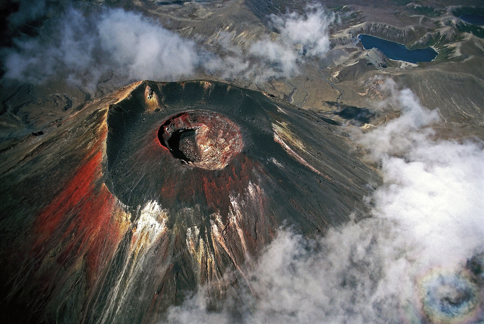
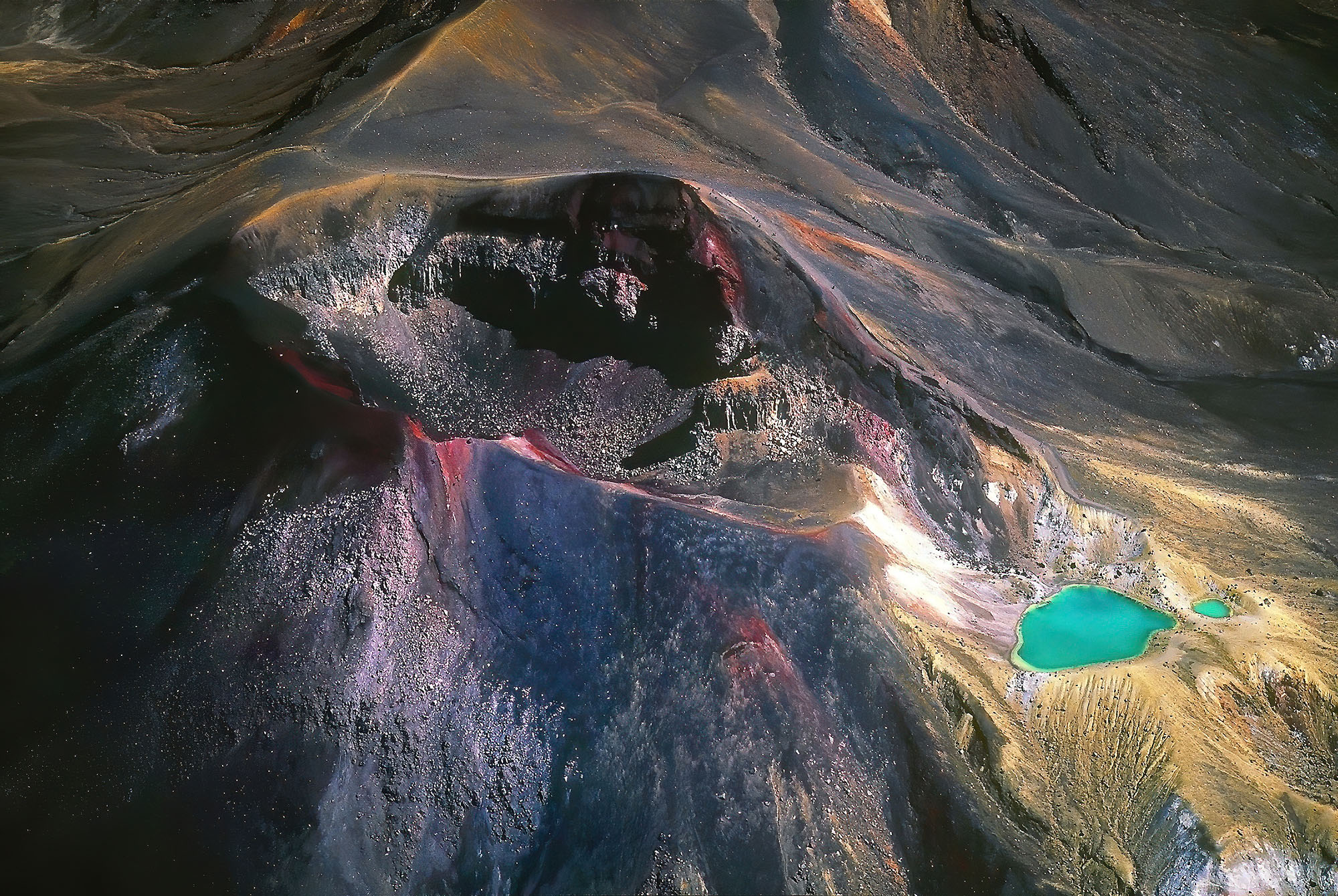
The aerial view of Mount Ngauruhoe volcano in New Zealand reveals its young and beautiful crater that last erupted in 1973 and 1975. Its steep slopes are covered with colorful ash and pumice. The 2300 m (7500 ft) high and perfectly shaped stratovolcano consists of layers of explosive andesite lava and pyroclastic tephra.
-
-
The Ngauruhoe in the volcanic arc of Tongariro
Ngauruhoe
-
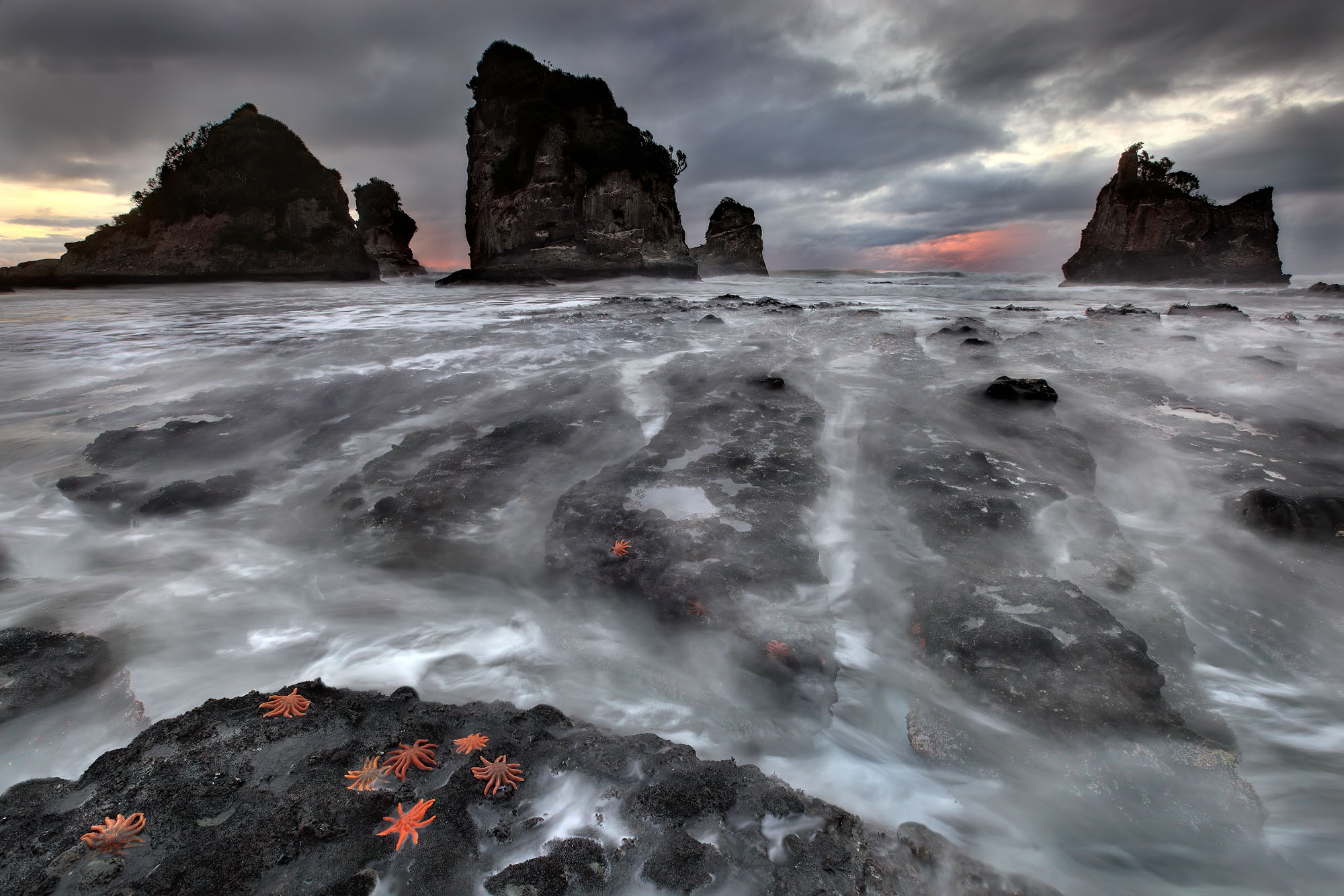
- The Whisper of the Rocks

-
- Keep Chasing a Dream
-

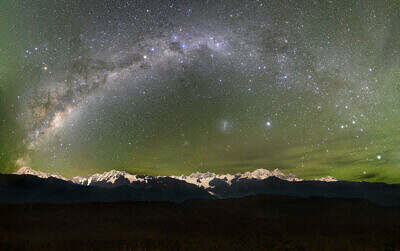
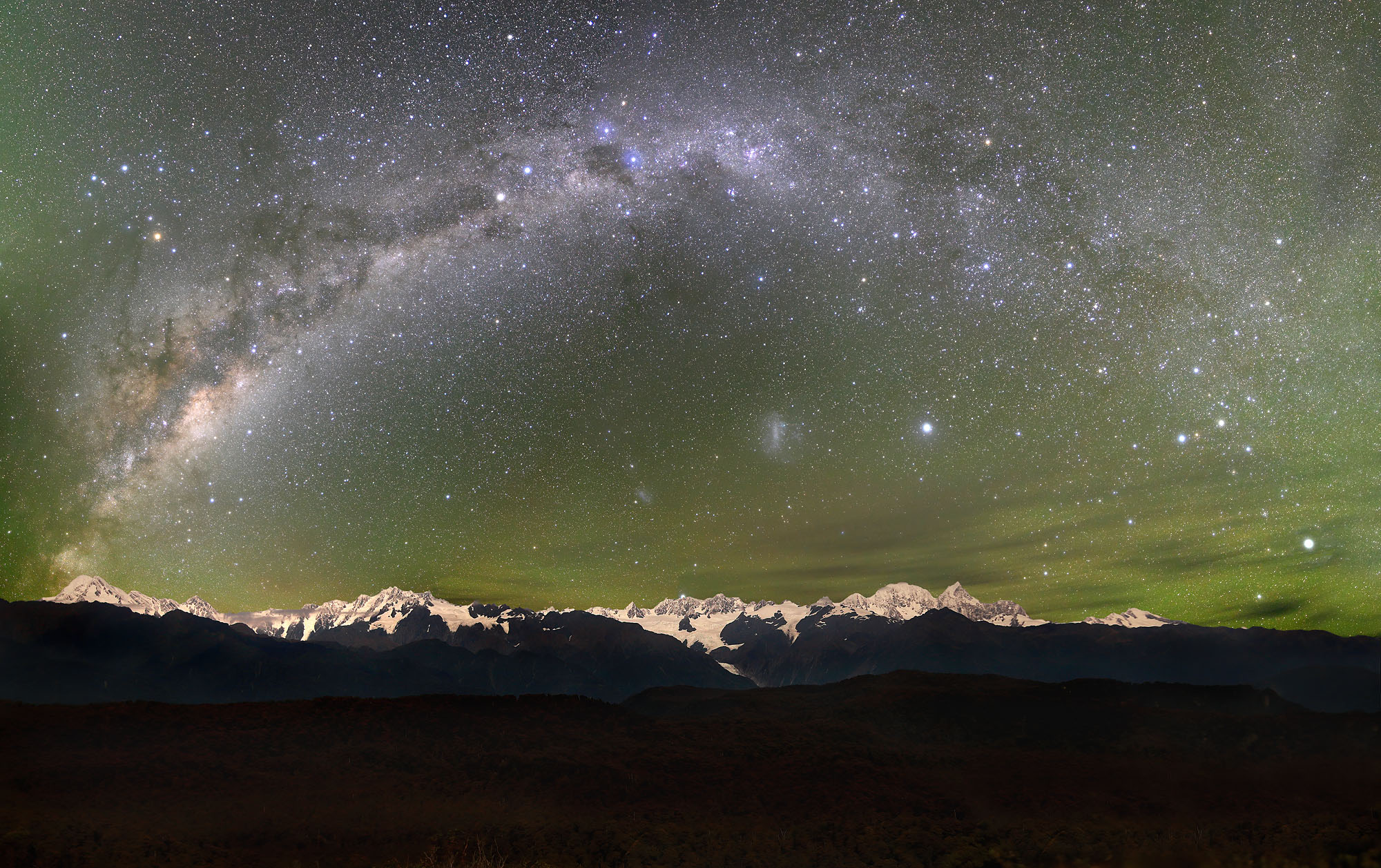
- Starscape
-
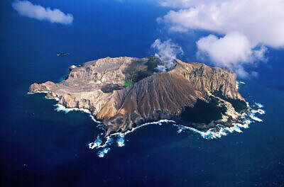
- Ring of Fire

-
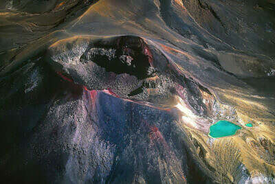
- Tongariro
-
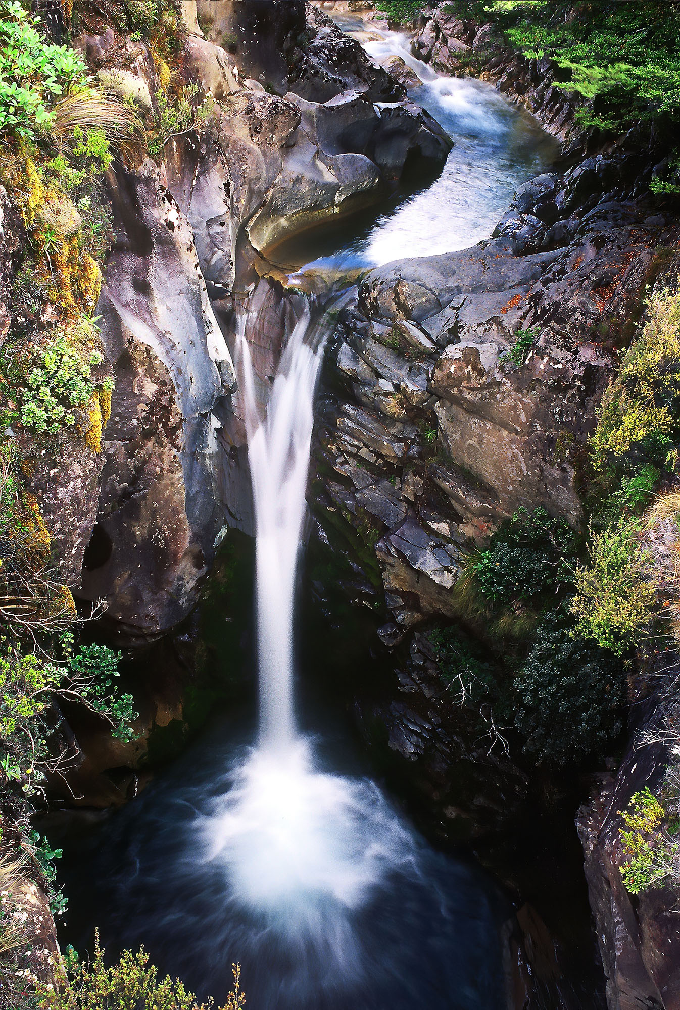
- Flow, River of my Soul